What is the Open Railway Map Project?
AKA: OpenRailwayMap
In short, Google Maps for the Railroad System around the world.
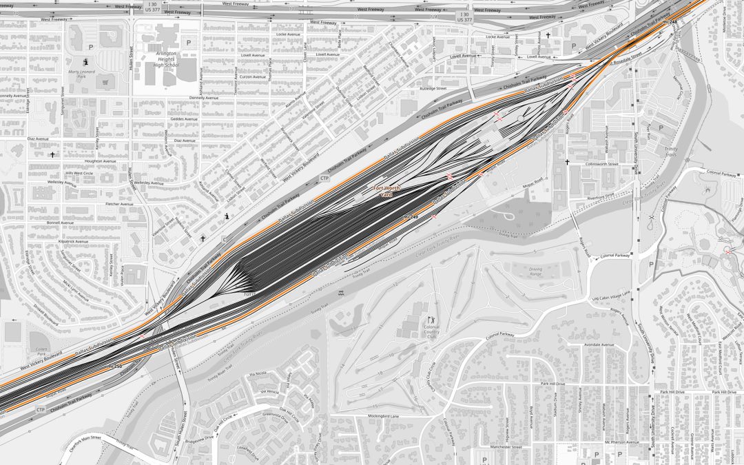
OpenRailwayMap is an open-source project and online platform that provides detailed maps and information about railway networks and infrastructure around the world. It is similar in concept to OpenStreetMap, which is a collaborative mapping platform for general geographic information, but OpenRailwayMap focuses specifically on railways.
OpenRailwayMap allows users to view and contribute data related to railway lines, stations, tracks, switches, tunnels, and other railway infrastructure. It is a community-driven project, and users can add, edit, and update railway information to improve the accuracy and coverage of the maps. This information can be valuable for train enthusiasts, travelers, and transportation planners.
The project typically relies on data from various sources, including government agencies, railway operators, and volunteers, to create comprehensive railway maps. The maps are made available to the public and can be used for various purposes, including trip planning, research, and railway infrastructure analysis.